 BLACK FRIDAY & CYBER MONDAY SALE
 BLACK FRIDAY & CYBER MONDAY SALE
 BLACK FRIDAY & CYBER MONDAY SALE
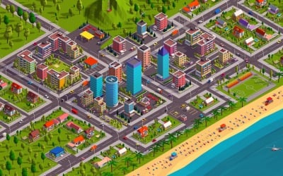
Polygonia Low Poly City Pack 3D Model by antonmoek
 BLACK FRIDAY & CYBER MONDAY SALE
 BLACK FRIDAY & CYBER MONDAY SALE
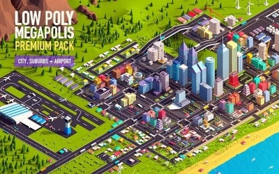
Low Poly Megapolis City Premium Pack 3D Model by antonmoek
 BLACK FRIDAY & CYBER MONDAY SALE
 BLACK FRIDAY & CYBER MONDAY SALE
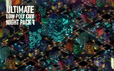
Ultimate Low Poly City Night Pack 1 3D Model by antonmoek
 BLACK FRIDAY & CYBER MONDAY SALE
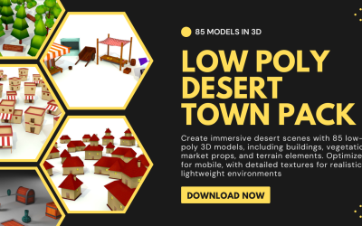
Low poly desert town pack of 85 Model in 3d by Babylon_Resources
 BLACK FRIDAY & CYBER MONDAY SALE
 BLACK FRIDAY & CYBER MONDAY SALE
 BLACK FRIDAY & CYBER MONDAY SALE
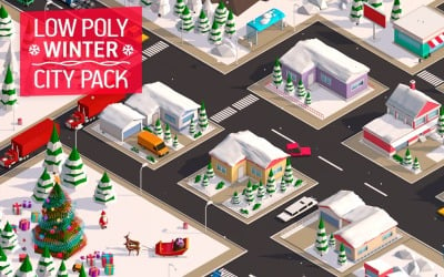
Low Poly City Winter Pack 3D Model by antonmoek
 BLACK FRIDAY & CYBER MONDAY SALE
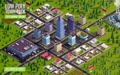
Cartoon Low Poly Town City Pack 3D Model by antonmoek
 BLACK FRIDAY & CYBER MONDAY SALE
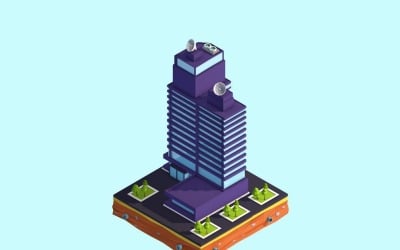
Cartoon Low Poly Business Center 3D Model by antonmoek
 BLACK FRIDAY & CYBER MONDAY SALE
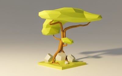
Low Poly Jungle Tree 3D Model by Leon
 BLACK FRIDAY & CYBER MONDAY SALE
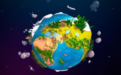
Cartoon Lowpoly Earth Planet 2 UVW 3D Model by antonmoek
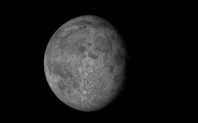 BLACK FRIDAY & CYBER MONDAY SALE
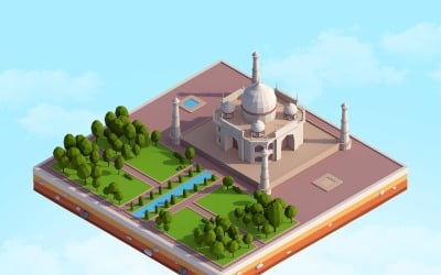 BLACK FRIDAY & CYBER MONDAY SALE
Cartoon Low Poly Taj Mahal Landmark 3D Model by antonmoek
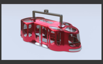 BLACK FRIDAY & CYBER MONDAY SALE
Hanging Cabin made of metal and glass by vova12zx
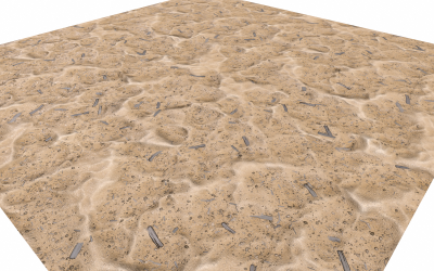 BLACK FRIDAY & CYBER MONDAY SALE
Sand Highpoly Landscape 3D model by Dofaco
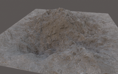 BLACK FRIDAY & CYBER MONDAY SALE
Landscape 3D Lowpoly model by Dofaco
5 Best Best Landscape 3D Models 2024
| Template Name | Downloads | Price |
|---|---|---|
| Low Poly Megapolis City Premium Pack 3D Model | 4 | $141 |
| Ultimate Low Poly City Night Pack 1 3D Model | 0 | $85 |
| Low Poly Jungle Tree 3D Model | 0 | $7 |
| Cartoon Lowpoly Earth Planet 2 UVW 3D Model | 5 | $18 |
| 3D Animated Travel Illustration | 0 | $22 |
Collection of the Best Landscape 3D Models
Transform parts of the Earth's surface into a beautiful 3D representation! With the help of state-of-the-art technology, you can now easily transform any flat surface into a three-dimensional masterpiece. Unleash your inner artist and create something astonishingly amazing with just a few clicks. Quickly and easily visualize your project with landscape 3D models from Templateog体育首页. These assets are realistic, have a lot of detail, and are ready to use. Just download the ones you need and use them in your projects to get the most out of them. See beautiful types of terrain as you've never seen them before, with bright colors and textures that will take you to a world of your own making.
How Does 3D Landscape Design Work?
Why 3D? Landscape architects often start the design process with pencil and paper, which is the preferred way to quickly and accurately try out different ideas. After the first step is done, designers move on to working directly with three-dimensional modeling software, which lets them build much more complex and creative designs. Working this way is great because it makes it possible to make truly unique designs.
Landscape 3D models are an ideal way to see how a project will turn out in places like mountains, beaches, forests, seas, meadows, and buildings. For example, it's helpful to see how the yard, house, and outside area will fit together into one cohesive space. It helps get a better sense of how much landscaping needs to be done and where certain plants or trees would look most appropriate.
The three-dimensional layout feature is a real game-changer. It provides a very realistic image by taking into account building materials, lush landscaping, and even changes in the land's shape. It's easy to see why it has become the solution of choice for architects, designers, engineers, and other professionals. This is because they want to get the most out of their projects by seeing a very accurate and detailed picture of them.
3D Terrain Modeling and Its Applications
When combined with aerial photography, computer-generated images of buildings can be an invaluable tool for many purposes. The information from aerial photos is put on top of a topographic model made from existing maps and elevation data. This gives a clear picture of the terrain and its features. This lets users learn significant things about the environment and make decisions based on the data generated.
Large-scale building projects may have their visual effect evaluated in advance using still photos and animations generated from landscape 3D models.
Here are some examples of their applications:
- Presenting information on trails, vegetation, man-made buildings, and geographical data in national and state parks, as well as other municipal agencies. By including these details in the model, viewers can gain valuable information about a park's aesthetics.
- Museums and galleries often utilize three-dimensional representations to showcase artifacts or monuments. This serves as a powerful teaching tool for viewers to gain a deeper appreciation of the subject matter.
- The military relies heavily on sophisticated landscape 3D models for strategic and tactical planning purposes. Having a clear, visually accurate view of the terrain (e.g., mountainous or desert), military intelligence can obtain information that allows them to develop effective plans.
- In the construction sector, 3D design is quickly becoming an invaluable asset for civil engineers, construction firms, and other professionals who are involved in the planning and design phases of a project. These cutting-edge models improve precision significantly, reduce expenses dramatically, and enhance safety significantly during the project.
Benefits of a Ready-Made Landscape 3D Model
With the help of landscape 3D models, you can quickly build beautiful outdoor spaces without doing the time-consuming work of drawing out the layout by hand. First and foremost, ready-to-use designs are very helpful for visualizing creative ideas and getting an accurate representation of what a finished product will look like. Additionally, these assets bring other benefits:
- By utilizing the power of three-dimensional technology, designers can provide a more immersive experience for their customers and help them better understand and visualize their ideas.
- With accurate lighting and shadows, three-dimensional representations provide a realistic impression that is easy to comprehend, even by those without any technical knowledge. This helps bridge the gap between architects and customers, making it easier for them to collaborate on creative projects.
- You can easily produce stunning visuals for any project, from movies to video games to educational materials. You can explore stunning designs of your favorite locations and add a whole new dimension to your designs. And all without ever leaving your seat.
Stop wasting hours and start downloading these beautiful landscape 3D models of landscapes today. With this collection, you'll have the freedom and flexibility to craft stunning, immersive visuals that will take your projects to the very top.
3D Landscape Model Software
Previously, architects and landscape designers relied on AutoCAD software as a primary tool when designing. But over time, many more 3-D modeling tools are being used to generate stunning visualizations. These tools range from SketchUp, Blender, 3ds Max, Maya, and Unreal Engine, to name a few. All of these tools allow for the awe-inspiring designs that we see on this page, and it is recommended that you employ them for further editing as well.
SketchUp
You can kickstart your SketchUp modeling project with 2D CAD files, landscape 3D models, digital elevation models (DEMs), or even your photographs. The Geo-location tool in SketchUp makes it incredibly easy to import highly accurate topographical images with just the click of a button. With the help of advanced computer algorithms, contour lines allow for all kinds of surfaces. In a very short amount of time, this technology has changed the way architects design and plan landscapes.
Moreover, you can use multimedia, like animations and video clips, to give your model more depth. You can get your design message across by sending high-resolution photographs and videos of many iterations and intricate details. Similarly, if you use a virtual or augmented reality headset to take your project to the next level, SketchUp will help you leave them in awe.
Blender
When it comes to free landscape 3D models, the open-source Blender software is the king of the hill. Not only does it make rigging, animation, simulation, rendering, composting, and tracking motion easy, but its powerful tools also let you develop amazing videos and even games.
- Using the Cycles renderer. Blender's ability to render ultra-realistic scenes is made possible by its built-in Cycles engine. This powerful technology allows for stunning visuals with ease and brings their creative visions to life with dazzling photorealism.
- UV mapping, modeling, & sculpting. With its comprehensive modeling toolset, you can easily create, modify, and render your landscape 3D models with ease and precision. Plus, they will look more realistic thanks to cutting-edge rendering capabilities.
- VFX. Blender offers powerful camera and object tracking features. This software makes it possible to seamlessly import raw video, accurately track it, mask off certain sections with ease, and then see the camera's motions in real time within a three-dimensional environment.
- Animation & rigging. Blender's rigging and animation features have made it one of the go-to tools for creating stunning visuals in a wide range of media, such as commercials, TV programs, and blockbuster films. The software has revolutionized how digital content is produced and its ease of use has allowed even newcomers to create complex animations with relative ease.
- Creating a 2D image in 3D. It's a smart move to include a three-dimensional viewport right away. Not only do 2D artists gain unprecedented workflow flexibility with this feature, but they also unlock the potential to create truly remarkable visuals.
Maya
Maya is an industry-standard tool for generating photorealistic, movie-quality special effects. With its powerful features, it can help you create realistic effects on terrain areas and lands, from majestic mountainsides to mesmerizing seascapes and everything else in between. The toolset, which won an Academy Award, is used to create photorealistic environments, such as breathtaking panoramas, awe-inspiring landscapes, and otherworldly vistas.
- Maya allows you to use a unified graphical programming environment to create realistic, physically plausible virtual worlds. Quickly import and manipulate massive datasets while using intuitive in-built editing tools to achieve the desired result quickly and efficiently.
- With the help of vertices, edges, and faces, polygon modeling is an extremely efficient way to create stunning landscape 3D models, structures, and other objects. Moreover, Maya offers extensive flexibility, as you can build anything from the combination of any geometric primitives and drawn curves with the help of the NURBS modeling approach.
- With the help of Arnold Render View, you can see the amazing effects of fine-tuning the scene's lighting, materials, and cameras in real time. You'll be able to witness immediate changes as you work on your project, allowing you to make creative decisions more quickly and efficiently.
Unreal Engine
Unreal Engine is the most powerful real-time 3-D development tool on the market right now. It helps create images that look like photos and experiences that are very immersive. With its advanced technological capabilities, Unreal Engine continues to change the way developers produce content and graphics. In particular, UE's innovative Landscape system is an easy way to quickly create large outdoor settings with realistic and detailed terrain. You can easily change the shape and look of any terrain, from majestic mountains to lush valleys, uneven or sloping ground, and even cave entrances.
With the LOD technology that Unreal Engine uses, developers can now make huge height fields with a resolution of up to 8192 by 8192. This means that it is technically possible to create even the largest outdoor settings. This memory-efficient system allows developers to create games from a wide range of genres without having to worry about technical limitations.
Static meshes aren't the most efficient way to make large terrains because they take up 6-7 times more memory than the Landscape system for the same number of points. Besides, the Landscape system uses a normal-height field, which makes it easier to store collision data and takes up less space than static meshes. In other words, it's much easier to store and manage collision data for a given environment with this system.
3DS Max
This is an immensely powerful piece of software that can be used to create an awe-inspiring 3D Max landscape design, from terrain modeling to generating impressive volumetric effects. Its ease of use and abundance of features make 3DS Max an attractive choice for professionals who want to take their artwork to the next level.
In particular, the terrain feature bundled with the software provides a plethora of capabilities. It can be utilized in numerous ways to create stunning virtual worlds:
- With the help of advanced modeling tools, it is now possible to create a realistic representation of how a project would potentially work in a real-world setting.
- Investigating the undulation of the topography to maximize vistas and sunshine. With the help of sophisticated mapping technology, it has become more convenient to observe the intricate details of topography. This has made it easier to take advantage of its unique features for enhancing landscapes.
- The use of color in data analysis for topographical changes makes it easier to identify patterns and recognize trends, providing key insights into the terrain.
- Creating digital representations of real-world areas by including a landscape model with buildings, vegetation, and infrastructure.
The Difference Between 2D and 3D Landscape Planning
These are two different approaches that have their advantages and disadvantages. The first one flatly shows the land, while the second one gives a more immersive experience with more depth and detail. Two dimensions create basic plans quickly, while three dimensions take longer but provide a higher degree of accuracy and realism.
In other words, landscape 3D models are the go-to option to view a highly detailed representation of a space. It's a convenient way to check out every part of a soon-to-be patio. For a designer, it's almost like watching a movie. You might find it easier to give final approval to a design that has been rendered in three dimensions because it shows the customer many important details.
Benefits include:
- An overview of the design’s larger scale from an aerial view. The ability to get an eagle-eyed view of the entire project and spot any little details that might have otherwise been missed.
- With the ability to view the layout from any angle, you can get a better understanding of the composition. You can also tweak it to make it look more aesthetically pleasing.
- A nighttime perspective and the ability to see your plants in every season.
- A preview of how the plants will look when mature.
- Three-dimensional landscape planning allows you to virtually experience the sound of a stream running through water features before they are even installed.
Bestselling Assets of the 3D Landscape: Download and Enjoy
If you’re looking to make your three-dimensional scenery stand out, you’ll want to access the highest-quality assets available. With the right assets, you can create a stunning three-dimensional world that will take your viewers on an immersive journey. Are you a beginner or a professional? It doesn't matter. Downloading these bestselling digital assets is sure to bring your vision to life.
Megapolis City
This animation-ready premium set of a sprawling metropolis is truly a sight to behold. Megapolis City was created in Cinema 4D. It has 57 buildings, 14 vehicles, an airport, road markings, a landscape, and an airport. All with a maximum of 3530000 polygons. In addition, the package comes in the .c4d file type and contains a Photoshop document file for post-production. All of its layers are neatly separated and clearly labeled for maximum convenience.
Under Water
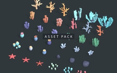
Have you ever wondered what the underwater world looked like? Well, now it is possible to explore the depths of the ocean with the help of this creative 3D asset. Under Water is a revolutionary animation tool that gives an out-of-this-world, extraterrestrial feel. It comes with 24 simple yet highly customizable objects with 36x36 pixel textures. This makes it ideal for creating any kind of mesmerizing, otherworldly image. Under Water features both low-poly and high-poly techniques. The asset is compatible with all the major 3D tools like Blender, ZBrush, Cinema 4D, SketchUp, 3DS Max, Maya, and Unreal.
Earth Planet
This beautiful 3D cartoon model of Earth was made using a UVW-textured design in Cinema 4D R17. It is ready to be used in a game. It has an impressive 188,190 polygons, which give it a smooth, detailed finish that will give any digital project a touch of fun. With this amazing asset, you can now represent the details of our planet in a stunningly beautiful way. Earth Planet has a realistic, physically-based rendering and low-poly mesh. This gives you a photorealistic and awe-inspiring view of the globe and lets you explore its wonders.
Incorporating Elementor PRO's Motion Effects Into a 3D Parallax Hologram
Landscape 3D Models Q&A
How can landscape 3D models be used?
Landscape 3D models are becoming a lot more common in this day and age. They're known for providing stunning visuals that leave viewers in awe. In a variety of contexts, you may put them to good use. For example, creating virtual reality experiences, improving the way a game or movie looks, or even just embarking on a virtual hike.
What software is used to edit landscape 3D models?
The most popular programs on the market right now include Maya, Cinema 4D, Blender, 3DS Max, Unreal, and Unity. Each of these incredible software packages comes fully packed with powerful features and capabilities. They make them suitable for creating mind-blowing visuals of parts of our planet. From mountains to valleys to rivers to oceans, these programs give you the tools you need to make landscape 3D models that look incredibly real.
How do I find the right landscape 3D models for my needs?
Here are a few steps to finding the most suitable design for your needs. First, please use the filters on the left sidebar to choose the features, software compatibility, file type, and color you need. Second, sort by price, number of sales, upload date, or rating—depending on what you prioritize. Lastly, look carefully at the screenshots the authors give you before you buy. This will ensure they're an appropriate fit for your needs.
What is the difference between nature and landscape 3D models?
Nature 3D models are created by taking photos of the natural environment and using them as reference points. Landscape designs, on the other hand, are generated by collecting data on landforms. You can also build them by scanning buildings or trees and making digital files from the scanned images.
